3PL
Third-party logistics
Customer-specific aisles and mixed-SKU storage that change daily. The digital twin keeps up with the floor — re-walk the area that moved, not the whole building.
Indoor navigation · Mapping · Digital twin
Print paper markers, walk the floor once, and your iPhone becomes a turn-by-turn guide to every shelf, pallet, and item — with a live digital twin and an audit log behind it. No hardware to install, no integrator to call.
The problem
Bluetooth beacons. UWB anchors. RTLS gateways. Lidar surveys, integrator fees, cabling, batteries to swap, quarterly recalibration. A working indoor-positioning system runs five to six figures — before anyone picks a single item.
So most operations skip it and live with the floor plan taped to the office wall. Pickers learn the aisles by muscle memory, new hires burn weeks getting oriented, and when an auditor asks where item #4471 went, someone goes looking.
TraceCapture makes a different bet: print a sheet of paper markers, walk the floor once, and ship — on the iPhone your crew already carries.
How it works
ArUco markers print on any office laser printer. Stick them to walls, racking, and beams at known waypoints. No power, no batteries, no network.
Open the app and walk the building with the camera on the markers. The phone solves the geometry as it goes and stitches a map of the space.
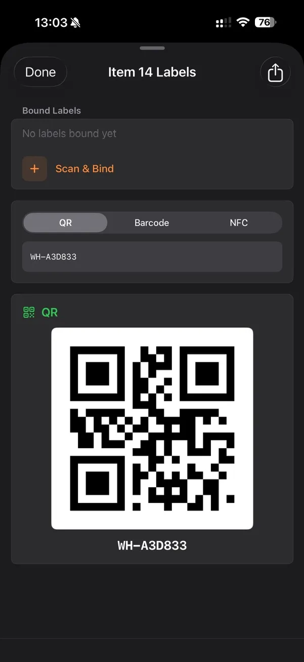
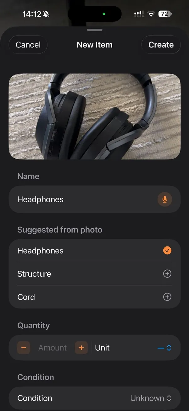
QR, barcode, or NFC — whichever sticker survives your environment. A photo auto-classifies the item with on-device ML; dictate notes in any language.
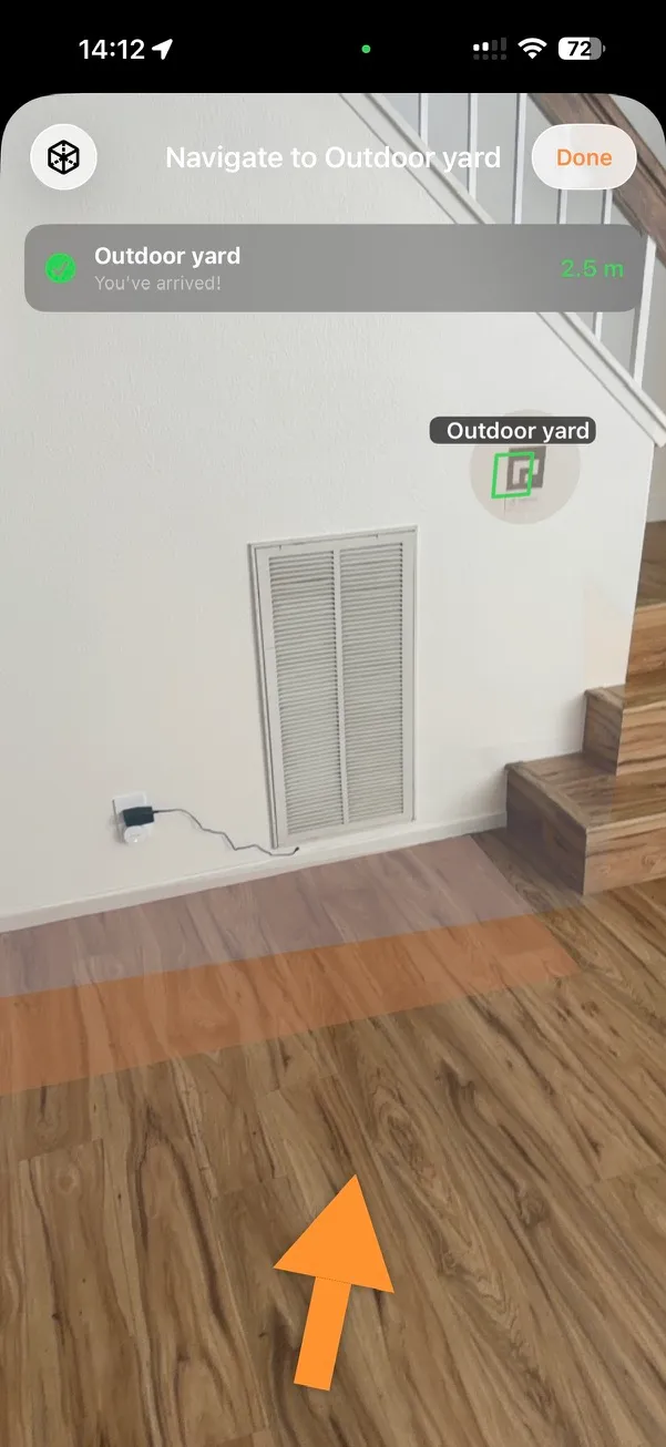
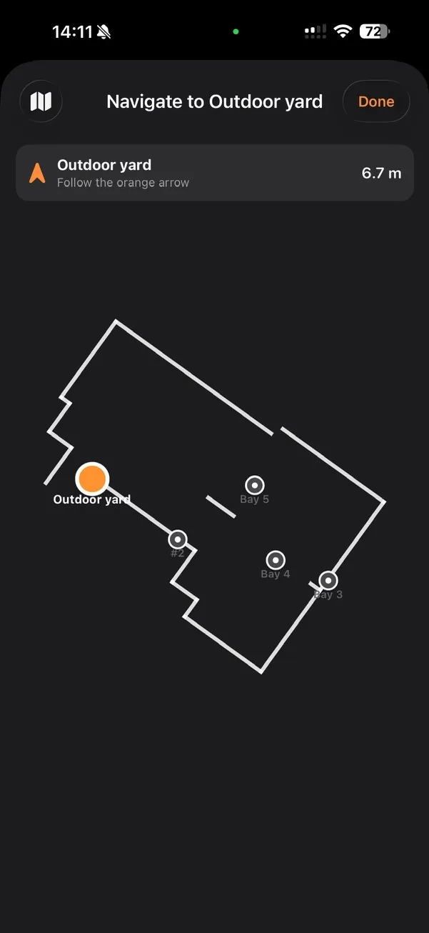
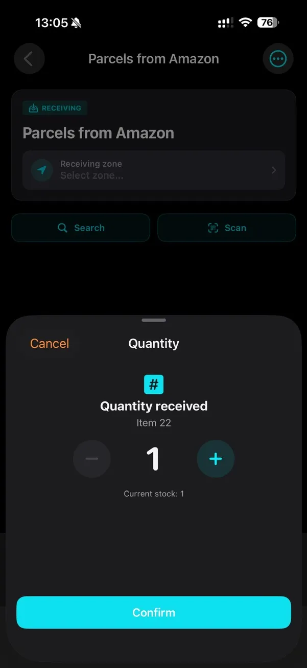
Any phone in the building routes to any item, shelf, or bay with an arrow on the floor. The camera is the compass. Fully offline; syncs when reconnected.
What's inside
Navigation, mapping, tagging, and order workflows — one app, running on a phone your crew already carries.
An arrow on the floor guides pickers through unfamiliar aisles to any bay, pallet, or item — ~30 cm accuracy, no drift between markers.
Every walkthrough updates a live model of the warehouse — top-down floor plan in the app, exportable as JSON today, glTF on the roadmap.
Location → container → item, all in one recursive tree. An append-only audit log captures every scan, photo, GPS fix, and signature.
Snap a photo and on-device ML suggests the item name and category. No typing, no lookup — edit and save.
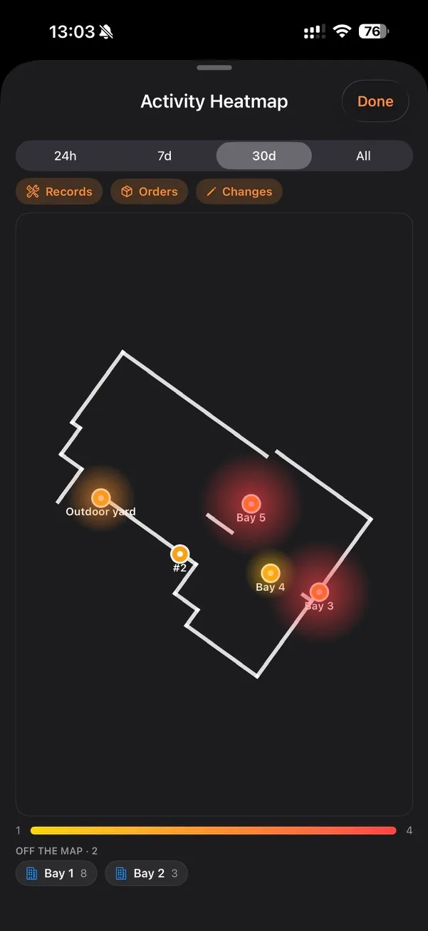
See where the work is happening on the floor plan — records, orders, and changes over 24h, 7d, or 30d.
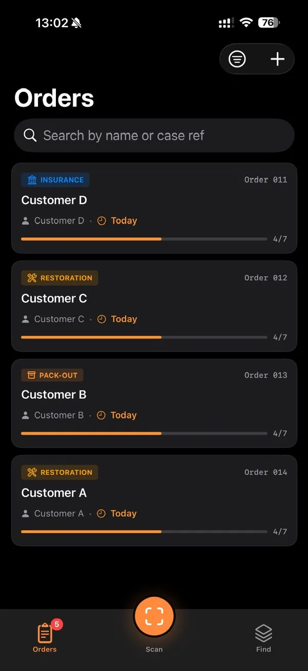
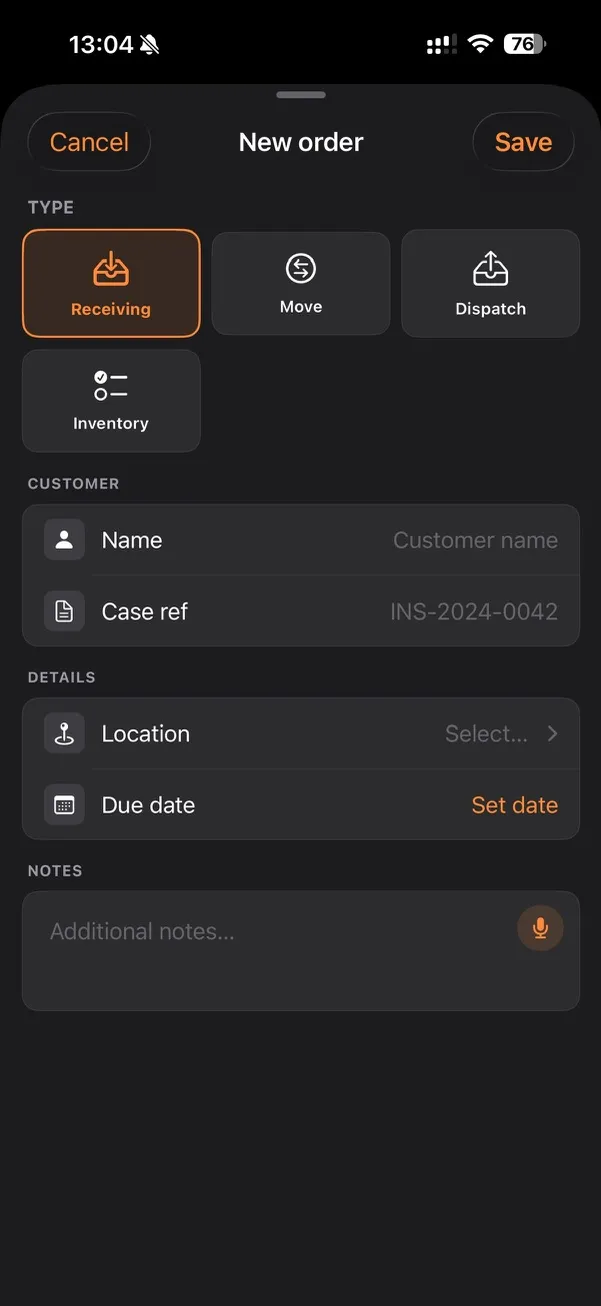
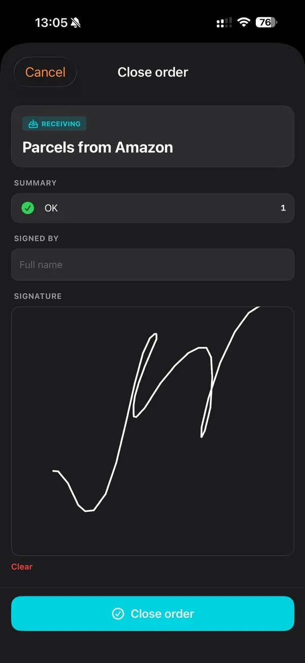
Receiving, dispatch, move, inventory, pack-out, claim. Each closes with an on-device signature. Export to PDF and XLSX.
ArUco for navigation, QR for items, NFC for high-touch surfaces, barcode for vendor SKUs. The phone reads whatever survived.
Capture, navigate, search, and sign with no signal — then sync on reconnect. iOS 16+. No tablets, kiosks, or laptops.
See it in the app
Everything below is captured straight from the iPhone app — navigation, mapping, tagging, and the order workflows that close with a signature.


vs. Traditional RTLS
| You need | Beacons / UWB / RTLS | TraceCapture |
|---|---|---|
| Setup cost | $20K–$100K hardware + integrator | $0 — print markers on any printer |
| Hardware on site | Beacons, anchors, gateways, servers | Paper markers + the phones you have |
| Power | Batteries to swap or AC to run | Nothing to power |
| Map updates | Surveyor revisit | Walk the changed area again |
| Item tracking | Separate WMS | Same app, same audit log |
| Calibration | Integrator visit | One person, one hour |
| Offline use | Depends on infra | Fully offline; syncs on reconnect |
| Failure mode | One dead beacon kills a zone | Lost marker? Print a new one |
Use cases
Customer-specific aisles and mixed-SKU storage that change daily. The digital twin keeps up with the floor — re-walk the area that moved, not the whole building.
An arrow on the floor takes pickers to the shelf without memorizing the layout. New hires are productive on day one, peak temps on day one.
Follow work-in-progress from station to station. Each scan extends the audit chain — no paper traveler to lose, no whiteboard to reconcile.
Audit every unit, prove condition at hand-off with photos, and locate anything in a 100,000 sq ft yard from a phone.
Insurance-ready chain of custody for fire and flood crews. Every item captured, moved, photographed, and signed — assemble the claim file as a PDF in minutes.
Stockroom maps that survive a seasonal reset. Find the one carton you need without pulling down three to read the labels.
FAQ
Get in touch
Tell us about your operation and we’ll send back a marker sheet, a TestFlight link, and a 30-minute onboarding call. Free pilot — no credit card, no commitment.